
 DJI Airport 3, deployable in vehicles for unmanned operations
 PJC8 Comprehensive Smart Pipeline Detector
 Daqi Tiancheng SHARE505S PRO 51 Megapixel Medium Format Aerial Camera
 Sel S10 Portable 3D Laser Scanner
 GHJS12 explosion-proof portable 3D laser scanner
 S10 Real-Time 3D Laser Scanner
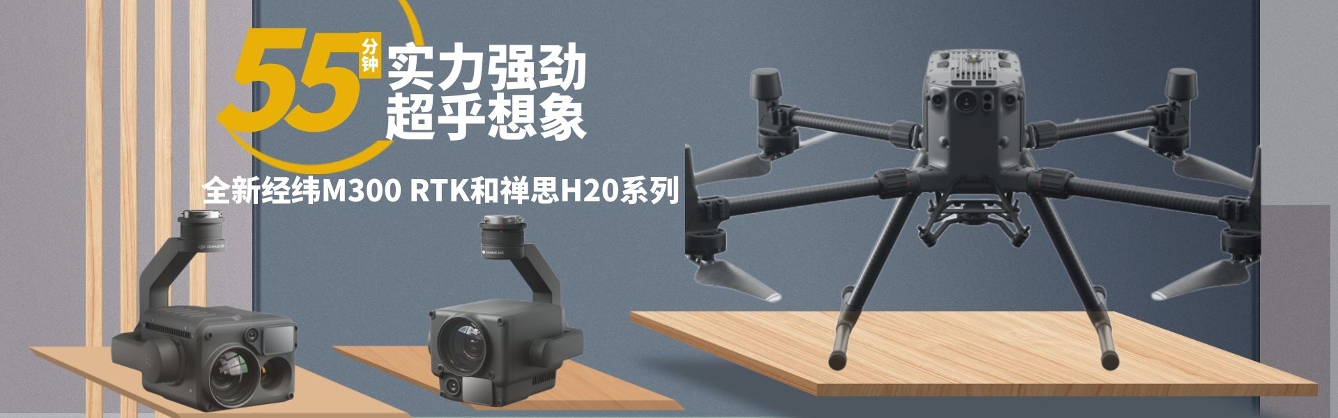
 DJI Airport 2+ Platform + AI Software
Product Details
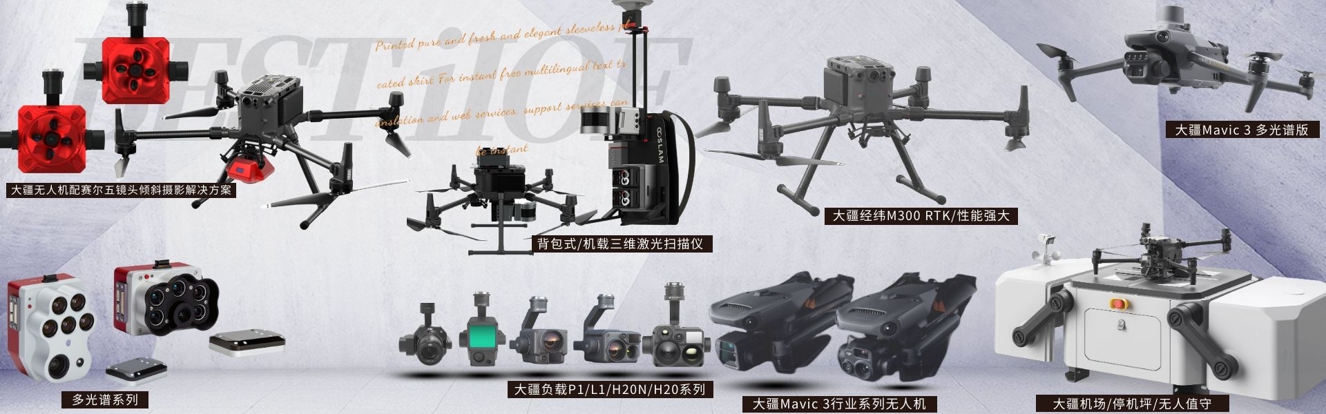
DJI drones and payloads, 3D laser scanners, ground-penetrating radar, multisp...

产品Price Negotiable
最小起订Quantity:1 Set 供货总Quantity: 20 Set


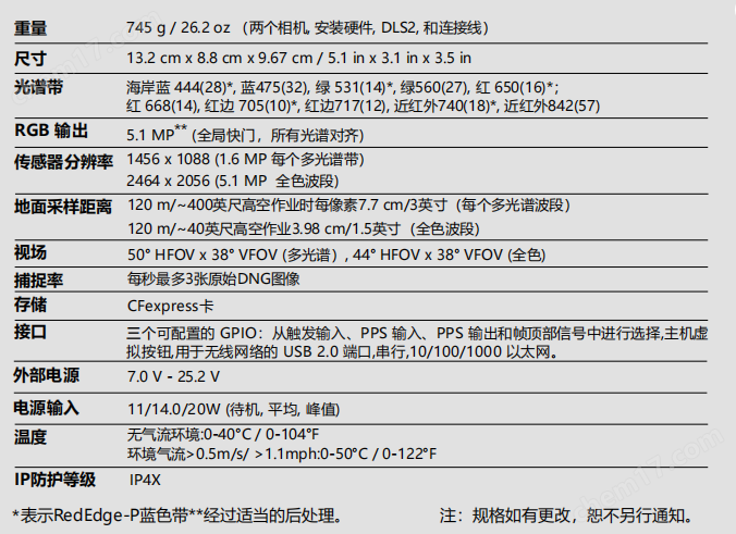
Weight: |
|
Dimensions: |
13.2 x 8.8 x 9.67 cm |
IP Protection Rating: |
IP4X |
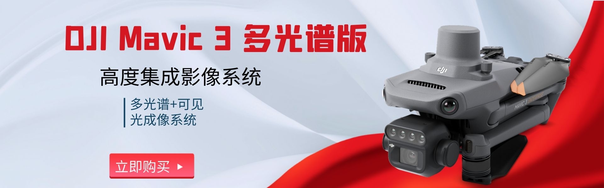
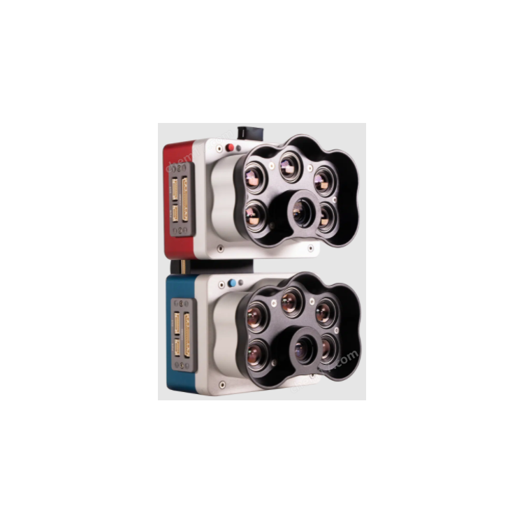
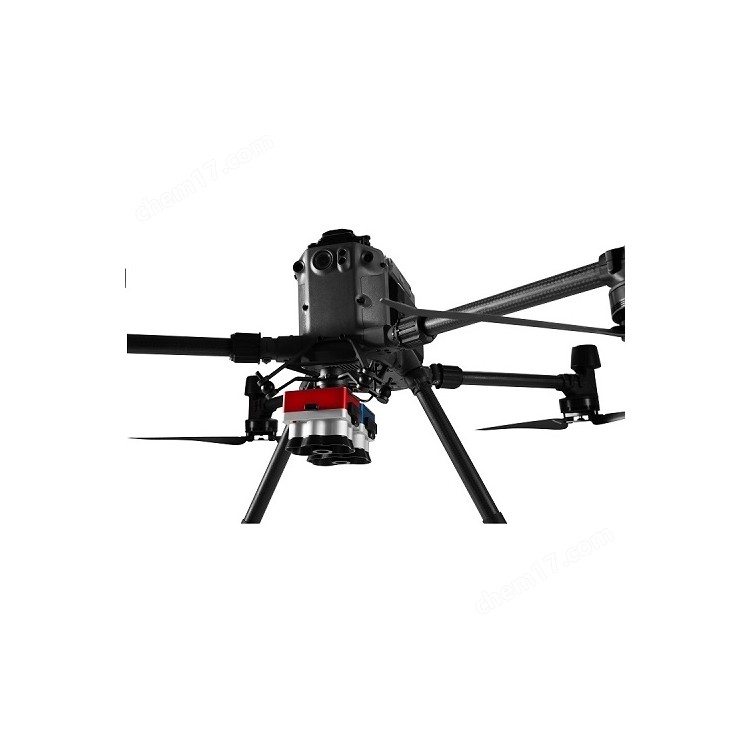
Shenzhen Pengjin Technology Co., Ltd. Welcome to inquire18320930028 Miss Lai DJIM350rtk drone multispectral camera with 10 spectral bands, offering outputs and indices like RGB, NDVI, NDRE, OSAVI, NIT, CIR, DSM, to generate invisible insights to the naked eye. The RedEdge-P dual's coastal blue band is designed for water vegetation analysis and weed identification in shallow water environments. Application: Water Vegetation Analysis Conduct chlorophyll efficiency testing, vegetation analysis, and identification of aquatic, floating, submerged, and emergent plants. Environmental Monitoring For coastal and shoreline water resource management, tidal沟 monitoring, wetland, and glacier surveillance. Water management, public water supply monitoring, water resource management Habitat monitoring, protection, and restoration; small-scale erosion and biodiversity inspections; coral reef surveys in shallow areas inaccessible to boats and sensitive to human activity. Vegetation types and weed identification Vegetation health management and species identification, including the ability to differentiate and count plants, trees, invasive species, and weeds. Advantages: Achieve image quality comparable to Landsat and Sentinel satellite data with enhanced resolution. Monitor shallow water environments with coastal blue belt. ● Conduct a detailed analysis of chlorophyll efficiency and identify weeds. ● Reliable time series analysis is possible under varying lighting conditions. Implement machine learning and AI applications, such as early crop counting. ● Generate invisible insights through multiple outputs and indices such as RGB, NDVI, NDRE, OSAVI, NIT, CIR, and DSM. Use your existing equipment - compatible with DJI Matrice 300/350 and various post-processing and flight planning software. Features: ● 10 multispectral bands, each 1.6MP ● Compared to the 10-meter/32-foot spatial resolution of satellites, the Pan Sharpening technology offers a spatial resolution of 2 centimeters/0.8 inches per pixel. ● Coastal Blue Spectrum Tape for Aquatic Vegetation Analysis and Weed Identification ● Dual light radiation calibration with a sunshine sensor and a calibration reflectance plate, ensuring reliable data under various light conditions; all 10 lenses feature global shutter, resulting in distortion-free images. ● Narrowband, enhanced data accuracy ● Fast capture rate - 3 raw DNG images per second, all 10 spectrums captured simultaneously, automatic triggering and geotagging of images, GAO-efficient flight time, and easy post-processing DJIM350rtk Drone Multispectral Camera - Quotation for 10 Spectral Parameters, please contact customer service. Shenzhen Pengjin Technology Co., Ltd. Welcome to inquireDJIDJIM350 RTK droneEquipped withMultispectral Camera10 Spectra
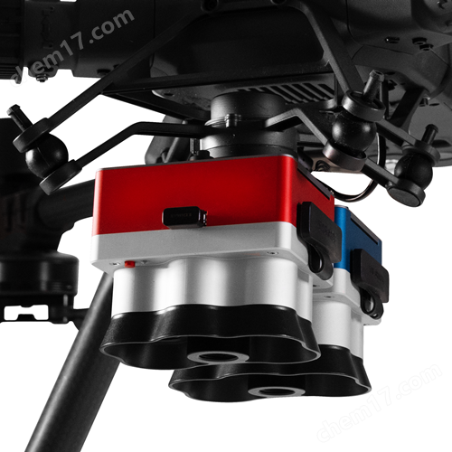
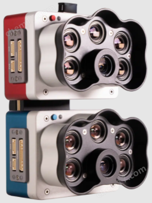
DJIM350 RTK DroneEquipped withMultispectral Camera10 Spectra

Phone Consultation
QQ Service