





Analysis of Drilling Costs and Main Technical Parameters of Rotary Directional Drilling
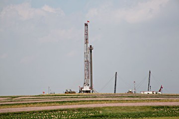
At present, complex wells with high difficulty such as horizontal wells, large displacement wells, and branch wells are flourishing worldwide and have been widely applied. Traditional drilling techniques are difficult to adapt to the operational needs of these high difficulty wells, and advanced rotary guidance technology must be relied upon to ensure the accuracy of wellbore trajectories. Below, the editor will share with you the main technologies of rotary directional drilling
The parameters are as follows:
Main technical parameters of rotary steering:
1) Measuring well depth: refers to the actual length of the wellbore between the wellhead and the measuring point.
2) Vertical well depth: The distance from the horizontal plane of a point on the wellbore trajectory to the wellhead.
3) Tilt point: the starting point of the inclination from the vertical wellbore section.
4) Well inclination angle: the angle between the wellbore direction line at the measuring point and the gravity line.
5) Azimuth angle: Starting from the true north direction line, rotate clockwise to the angle rotated by the azimuth line, which refers to the horizontal plane where the azimuth angle can vary between 0-360 °.
6) Deviation rate: Deviation rate refers to the change in inclination angle per unit length. Expressed in degrees/100 meters, degrees/30 meters or degrees can also be used.
7) Azimuth change rate: Azimuth change rate refers to the change in azimuth angle per unit length, expressed in degrees per 100 meters (degrees per 30 meters can also be used).
8) Dog leg severity: Dog leg severity is a parameter used to measure the degree of wellbore curvature or the speed of change (expressed in degrees/30 meters). Dog leg severity includes both changes in wellbore inclination angle and azimuth angle, and is a data that needs to be closely monitored during drilling. GR natural gamma is used to measure the radioactive content in geological formations, and clay in rocks contains radioactive substances
There are many materials. Usually, mudstone has a high GR and sandstone has a low GR.
9) CAL - Well Diameter
Diameter is the measurement of the size of the wellbore. For example, when drilling a wellbore with an eight and a half inch drill bit, the measured diameter may be eight and a half inches, or greater than eight and a half inches (called expanding diameter), or less than eight and a half inches (called reducing diameter). The measured wellbore diameter is a visual understanding of the size of the drilled hole.
10) AC sound wave
People often refer to sound waves as the time difference of sound waves, measured in milliseconds per foot. A small time difference of sound waves means that the time it takes for sound waves to propagate in the formation is less, indicating that the formation is relatively dense and hard. On the contrary, the strata are relatively loose.
11) CN neutron
Using a radioactive source to emit high-energy particles to bombard atoms in the formation to measure neutrons, also known as neutron porosity or total porosity, measures the percentage of fluid volume in the entire rock.
12) Resistivity
The resistivity is divided into micro lateral and bi lateral (including shallow lateral and deep lateral), and their difference lies in the different detection depths. The deep lateral detection depth is greater, followed by the shallow lateral, and the micro lateral detection depth is smaller. Due to the different invasions of mud into the formation, the wellbore can be completely invaded by mud, partially invaded by mud, or not invaded by mud within different radius ranges
This corresponds to the geological formations detected in micro lateral, shallow lateral, and deep lateral directions, respectively.